Franklin County Culverts
Northwest Regional Planning Commission – Town Inventory Update
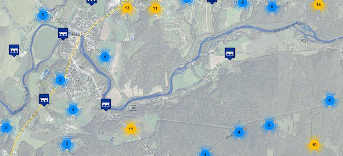
Trudell Consulting Engineers was selected to collect inventory of culverts and bridges throughout Franklin Country Vermont for the Northwest Regional Planning Commission. TCE’s GIS Analyst traveled throughout Franklin, Georgia and Richford on town roads to locate and map all known and unknown culverts and bridges and to show the conditions of each on all Class 1, 2 and 3 town highways. A data dictionary was set up on the Trimble GeoExplorer 6000 Series GPS unit.
After collection, this information was uploaded to a NRPC website which included GIS mapping data and reporting details, images.
Franklin County Culvert Inventory
During the summer of 2014, TCE performed a bridge and culvert inventory for Northwest Regional Planning Commission in Franklin, Richford and Georgia. Our GIS Analyst collected location and attribute information on over 1,000 structures.
Each GIS point included information on the type of culvert, material, whether or not erosion was present, size, condition, a picture and other relevant information.
This information was then compiled, reviewed for quality control and uploaded to the Vermont Online Bridge and Culvert Inventory Tool, to be used by the Agency of Transportation, Regional Planning Commissions and the public.
This project faced tight project deadlines as well as budgetary constraints due to the client’s funding sources. TCE was able to collect all the data within the timeframe while staying within the project budget.
Related Projects

![]()